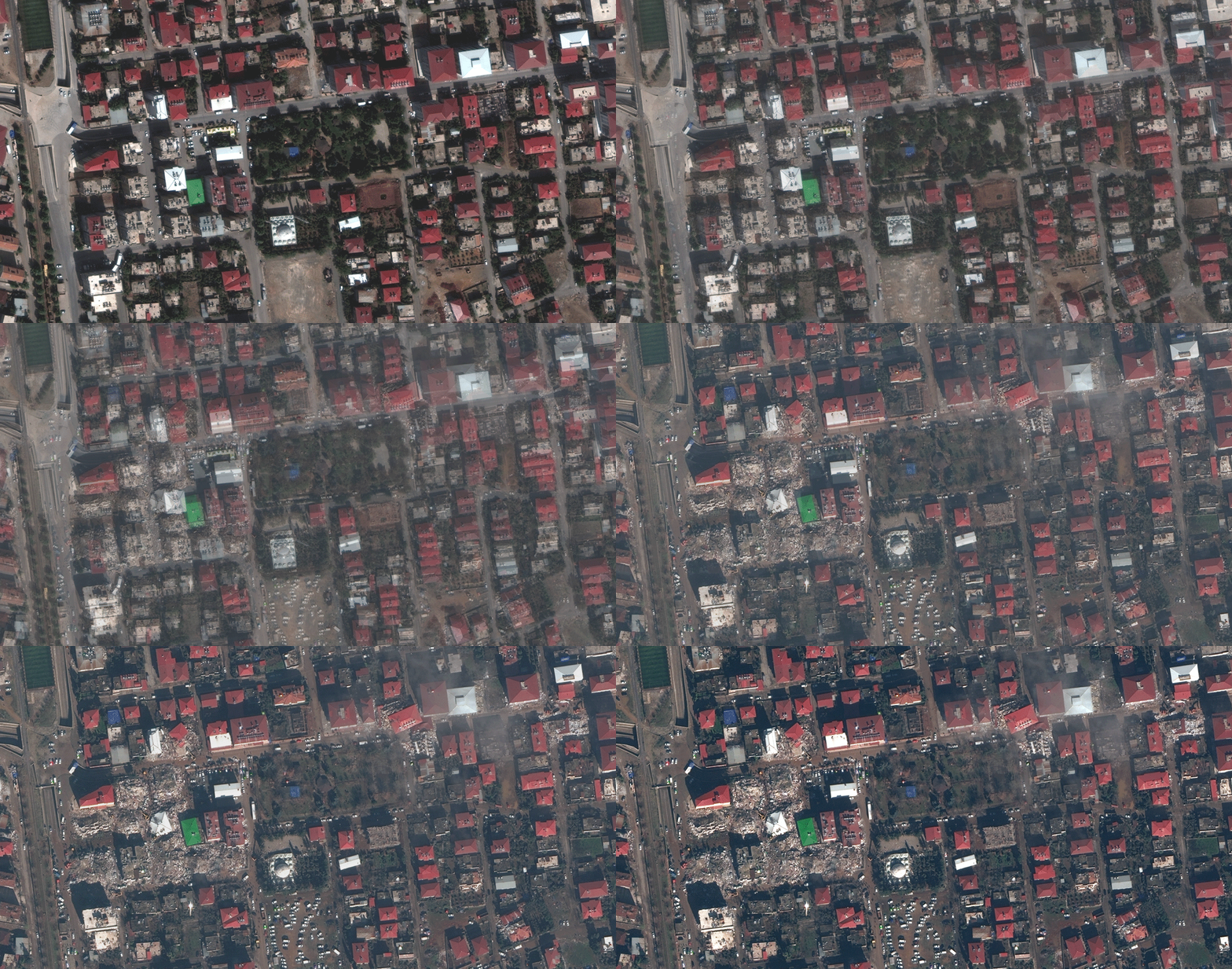
From space, the scale of the devastation caused by the two massive earthquakes that struck Turkey and Syria is clear.
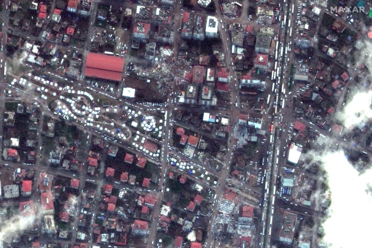
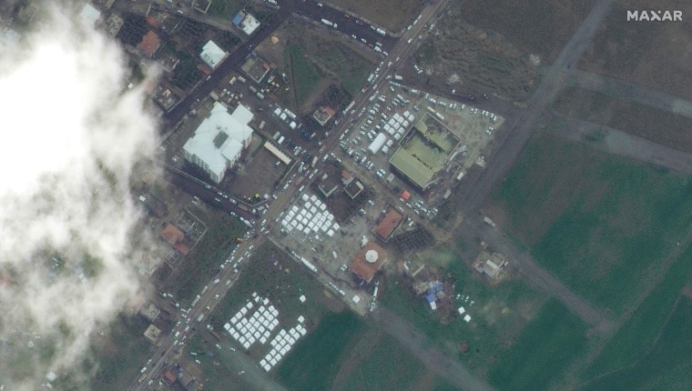
Photographs taken Tuesday by Maxar Technologies, a Colorado-based US defense contractor, show an aerial view of several Turkish cities before and after the tremors, which have killed at least 11,000 people.
Rubble from several collapsed towers that once stood in the neighborhood can be seen in an image of Islahiye, a small town of around 70,000 near Turkey’s southern border with Syria. Trees within a green park adjacent to the city’s Hacı Ali Ozturk Mosque in Islahiye also appear to be completely uprooted.
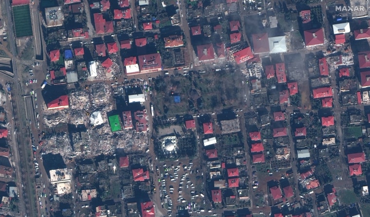
Elsewhere, terracotta tiles from the roofs of several houses were thrown to the ground in the Gaziantep province city, once part of the Iron Age kingdom of Sam’al.
Just 10 miles north of Islahiye, archaeologists, including a team from the University of Chicago and the German University of Tübingen, have been working with local people since 2006 to excavate a site at Zincirli Höyük in search of relics from the Old Age. of the Bronze and Iron Age.
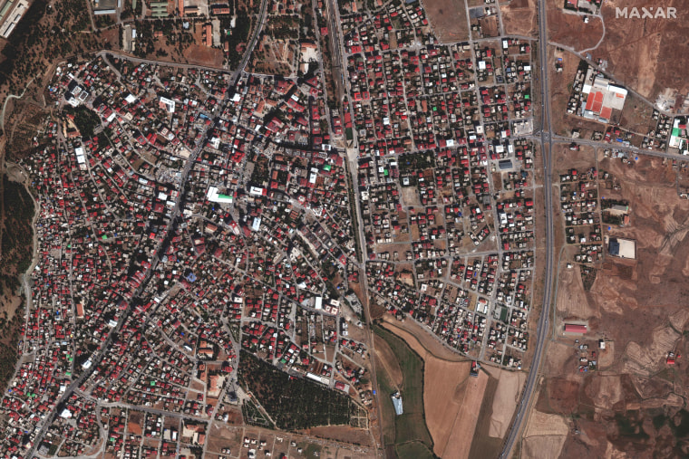
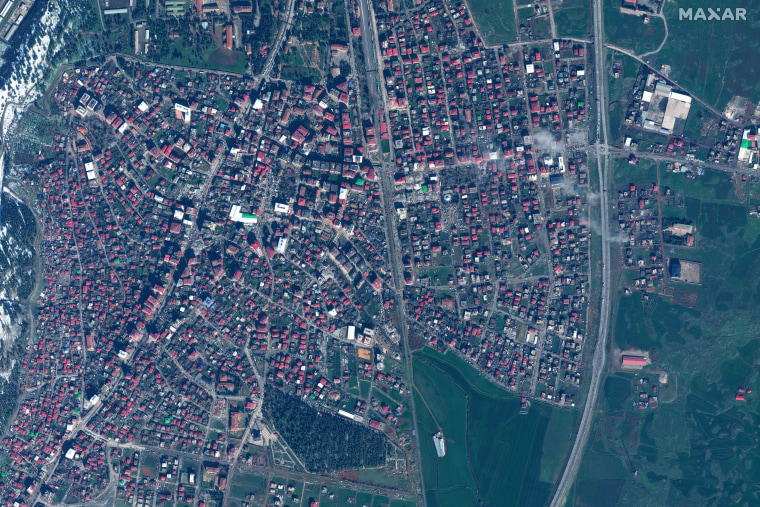
At the epicenter of the first quake in Nurdağı, a city of around 40,000, dozens of white tents, probably shelters for survivors and emergency teams, can be seen lining the roads and streets.
The quake, which struck early Monday morning local time, registered a magnitude of 7.8 and was classified as «major» on the official magnitude scale. Hours later, a second, with a magnitude of 7.6, struck nearby.
Authorities have warned that the death toll in the mountainous region known for the production of cotton, red pepper and wheat is likely to rise as many remain trapped under rubble in sub-zero temperatures overnight.
According to the World Health Organization, up to 23 million people are likely to have been affected, including around 1.4 million children.
«Now it’s a race against time,» WHO Director-General Tedros Adhanom Ghebreyesus said on Tuesday. «Every minute, every hour that passes, the chances of finding survivors alive diminish.»

